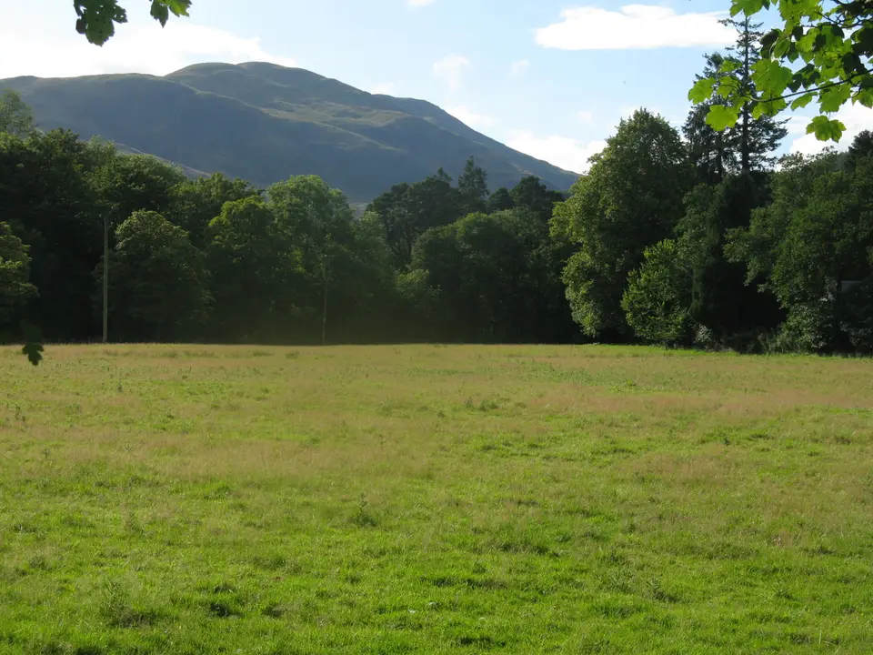

Ben Ledi
Hill walk above Loch Lubnaig, near Callander
Verdict
Go for the best all-round view in the Trossachs, on a path that is built for most of the climb. Pick a clear, dry day.
Skip if the top is in cloud, the wind is strong or you cannot give it 4 to 6 hours with daylight to spare. The car park fills early on summer weekends.
- Ben Ledi car park. The start. Forestry and Land Scotland car park, no charge, off the A84. It fills early on summer weekends.
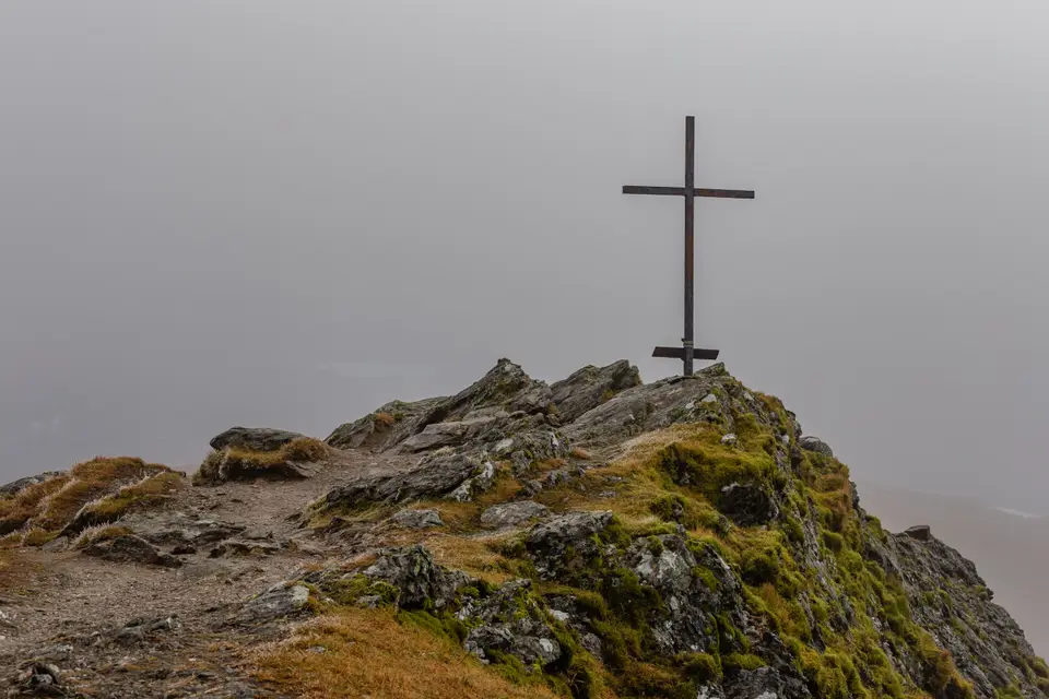
- Ben Ledi, 879 m. The highest hill in the Trossachs, with a cairn from 1887 and an iron cross.
- Distance
- c. 10 km
- Time
- 4–6 h
- Ascent
- 770 m
- Parking
- Free
Today: 10°C and showers, sunset 18:21. Summer weekends fill the car park early. Start early.
Ben Ledi in photos



Is it for me?
Ben Ledi is a hill walk of about 10 km of 4 to 6 hours with about 770 m of climbing, and its summit at 879 m is the highest in the Trossachs. It is a Corbett, not a Munro. The walk starts at a free Forestry and Land Scotland car park off the A84 between Kilmahog and Loch Lubnaig, a short drive from Callander. Route figures here come from Walkhighlands, because the park and forestry pages give none, so treat them as a guide and allow generous time. Pick a clear day and check the month-by-month weather before you set out.
- Beginners
- A fair first hill if you are fit. The ascent is on a built path, but it is still a 4 to 6 hour mountain walk, so carry hill gear and food.
- Children
- Suits children who already walk for hours. There is 770 m of climbing, some of it steep, and no short way down.
- Dogs
- The forestry pages do not set dog rules. Keep dogs close, on a lead near livestock, and check signs at the start.
- Buggies
- Not suited to buggies or wheelchairs: the path is steep and has stone steps.
- Terrain
- A constructed hill path for the ascent, with stone steps. The descent by Stank Glen is rougher and boggy in places (bog factor 4 out of 5).
- Navigation
- The ascent path is easy to follow. In cloud the summit and the Stank Glen descent need a map and compass. If unsure, go back the way you came.
Map of the walk
- Ben Ledi car park. The start. Forestry and Land Scotland car park, no charge, off the A84. It fills early on summer weekends.
- Ben Ledi, 879 m. The highest hill in the Trossachs, with a cairn from 1887 and an iron cross.
Map © OpenStreetMap contributors. Open in maps
Ben Ledi summit weather
This is the forecast for the top of Ben Ledi at 879 m, not for Ben Ledi car park (Forestry and Land Scotland). Air cools by about 6.5°C for every 1,000 m you climb, so the summit is usually around 6°C colder than the loch shore, and the wind is often two or three times stronger. "Feels like" adds the wind chill. If the cloud base is below the summit you will walk in cloud, so take a map and compass.
| When | Weather | Temperature | Feels like | Wind | Summit in cloud |
|---|---|---|---|---|---|
| Today 12:00 | showers | 6°C | 2°C | SW 13 mph | unlikely |
| Today 15:00 | heavy rain | 6°C | 2°C | SW 16 mph | possible |
| Tomorrow 09:00 | light rain | 6°C | 2°C | S 11 mph | possible |
| Tomorrow 12:00 | rain | 7°C | 3°C | SW 17 mph | likely |
| Tomorrow 15:00 | rain | 9°C | 5°C | SW 19 mph | possible |
| Thursday 09:00 | cloudy | 6°C | 3°C | W 8 mph | unlikely |
| Thursday 12:00 | cloudy | 6°C | 3°C | SW 10 mph | unlikely |
| Thursday 15:00 | cloudy | 7°C | 4°C | SW 10 mph | unlikely |
Freezing level, midday estimate. Today: about 1,800 m. Tomorrow: about 2,000 m. Thursday: about 1,850 m.
Forecast for 879 m from MET Norway (yr.no), CC BY 4.0, with wind chill and freezing level worked out by us. Updated Tue 13 Oct, 10:30.
For a full mountain forecast, including the chance of cloud-free summits, see the MWIS Southern Highlands forecast.
The route, step by step
-
Ben Ledi car park
Turn off the A84 on the road signed for Strathyre Forest Cabins, cross the bridge and turn left for the car park. A few more spaces lie over the bridge. Walk back to the junction beside the bridge and take the signed footpath up into the woods.
-
Up through the woods
The path climbs through trees and passes a grove planted in memory of soldiers from Callander lost in the First World War. Cross the forest track and keep climbing. There are stone steps, and you get views back to Loch Lubnaig.
-
The southern nose
The path swings left towards the southern nose of the hill. Callander and the lowlands open up, and Loch Venachar comes into view. Near the top of the nose the path turns right onto the south-east ridge.
-
The ridge
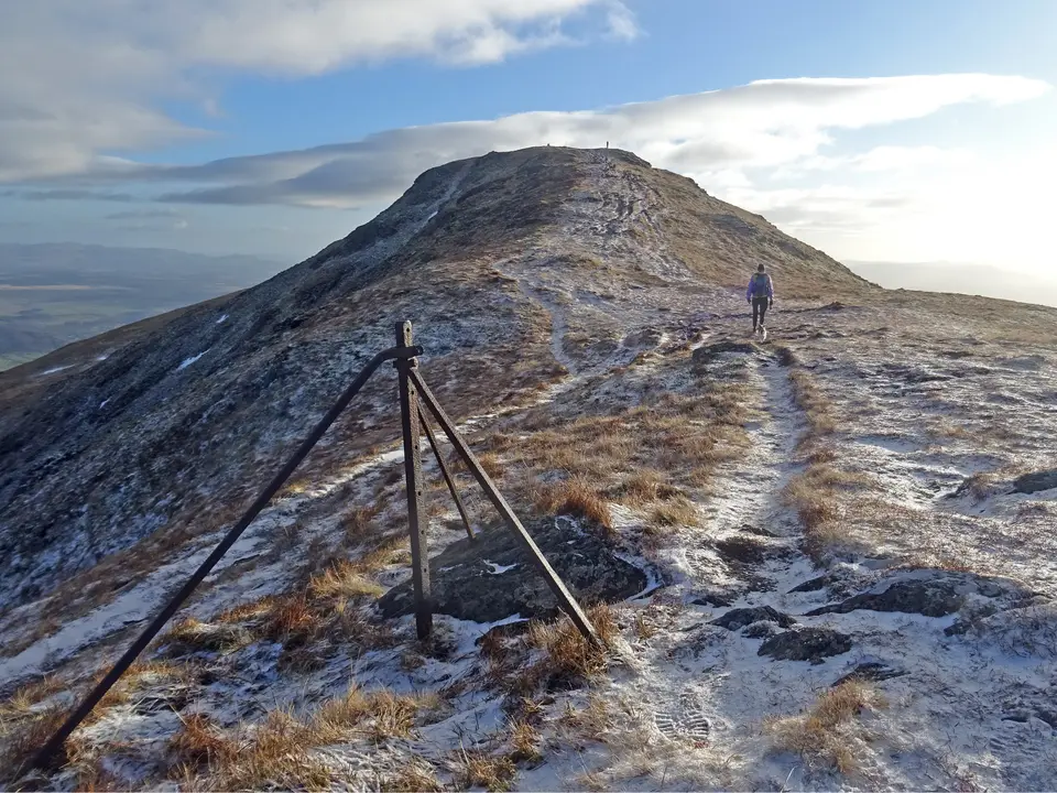
The ridge is broad with a good path. It rises over two grassy false summits, each followed by a short drop. From the second, the true summit comes into view, rockier and topped with an iron cross.
-
The summit
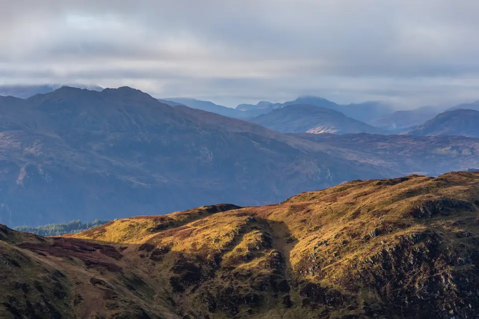
The iron cross is a memorial to a mountain rescue team member. A little further on is the cairn, built in 1887, and the trig point. You can see Loch Lubnaig, Loch Venachar, Ben Lomond and the Arrochar Alps. The easiest way down is to retrace your steps.
-
Optional: down Stank Glen
A longer descent follows the ridge to the bealach and drops into Stank Glen. The path fades in places and is boggy, and missing the bealach can put you above crags. Choose it only in clear weather and with a map and compass.
Parking & getting there
Ben Ledi car park (Forestry and Land Scotland)
- Where
- Off the A84 between Kilmahog and the south end of Loch Lubnaig. Follow signs for Strathyre Cabins, cross the bridge and turn left. Postcode FK17 8HF.
- Price
- No charge to park.
- Busy times
- Very busy on summer weekends. Arrive early or have a second plan.
- Toilets
- None at the car park. The nearest public toilets are in Strathyre to the north or Callander to the south.
- Cycling
- National Cycle Route 7 passes the car park.
- Safety alerts
- The forestry page carries tick and open-water alerts for the area. Check it before you go.
Last checked 13 Oct 2026
Car-free
No public transport reaches the start. The Trossachs Explorer calls at Kilmahog, and from there it is a 2 km walk past the Falls of Leny to the car park. Public buses also link Callander and Killin through Strathyre, so check Traveline Scotland for the stop and the last bus home. Callander's own car parks are not near the start; the Callander car park guide covers them. For the wider picture, see getting to Loch Lomond.
When it is busy
Editorial estimate of a typical summer day, on the path and at the start. These are not measured counts.
| Day | 8:00 | 9:00 | 10:00 | 11:00 | 12:00 | 13:00 | 14:00 | 15:00 | 16:00 |
|---|---|---|---|---|---|---|---|---|---|
| Weekday | Quiet | Quiet | Steady | Steady | Steady | Steady | Steady | Quiet | Quiet |
| Saturday | Quiet | Steady | Busy | Busy | Busy | Busy | Busy | Busy | Steady |
| Sunday | Quiet | Steady | Busy | Busy | Busy | Busy | Busy | Steady | Quiet |
Q QuietS SteadyB BusyF Car park full
Tip: start by 9am on a summer weekend, or go on a weekday.
Call it off if
- The top is in cloud: the view is the point, and the summit and Stank Glen descent are harder to read.
- Strong wind is forecast: the ridge and summit are exposed.
- There is snow or ice on the path and you do not have winter kit.
- Less than 6 hours of daylight remain: allow 4 to 6 hours plus a margin.
- It has rained heavily: the descent by Stank Glen is boggy at the best of times.
Make a day of it
Morning
Beat the crowds
- Early Park by 9am on a summer weekend and set off up the woodland path.
- +4–6 h Back at the car park, with daylight to spare. Allow more for the summit view.
Midday
Back to the trailhead
- After National Cycle Route 7 passes the car park, so cyclists can pick it up here.
- Option If the top is in cloud, leave the hill for another day and pick a lower walk from the walking routes in the park.
Afternoon
Food and rest
- Late The nearest food and toilets are in Strathyre or Callander. See our Strathyre guide for the village.
- Stay Forest Holidays Strathyre has 46 woodland cabins near Ben Ledi, many overlooking Loch Lubnaig.
Where to stay near Ben Ledi
Partner links: we may earn a commission
Questions people ask
How long does it take to climb Ben Ledi?
Allow 4 to 6 hours for the round trip of about 10 km, with about 770 m of climbing. The time depends on your pace, so add a margin for the summit and breaks.
Is Ben Ledi a Munro?
No. At 879 m it is a Corbett, a hill between 2,500 and 3,000 feet, and the highest summit in the Trossachs.
Where is the Ben Ledi car park?
Off the A84 between Kilmahog and the south end of Loch Lubnaig, postcode FK17 8HF. Follow the signs for Strathyre Cabins, cross the bridge and turn left.
Is the Ben Ledi car park free?
Yes. There is no charge, which is why it can be very busy on summer weekends. Arrive early.
Is Ben Ledi hard?
It is a proper hill day rather than a stroll. The ascent is on a built path with steps, but there is 770 m of climbing and the top is exposed. The easiest way down is to retrace your steps; the Stank Glen descent is rougher.
Can you walk to Ben Ledi from Callander?
The route in this guide starts at the Ben Ledi car park, not in Callander. The nearest bus stop is at Kilmahog, 2 km from the car park.
What can you see from the top of Ben Ledi?
Loch Lubnaig, Loch Venachar, Ben Lomond and the Arrochar Alps, with the lowlands to the south. The summit has a cairn from 1887 and an iron cross.
Can I get to Ben Ledi without a car?
Only with a walk. The Trossachs Explorer calls at Kilmahog, and from there it is 2 km to the car park. Check Traveline Scotland for times.
Where can I stay near Ben Ledi?
Strathyre and Callander are the closest. Browse Callander accommodation compared for options.