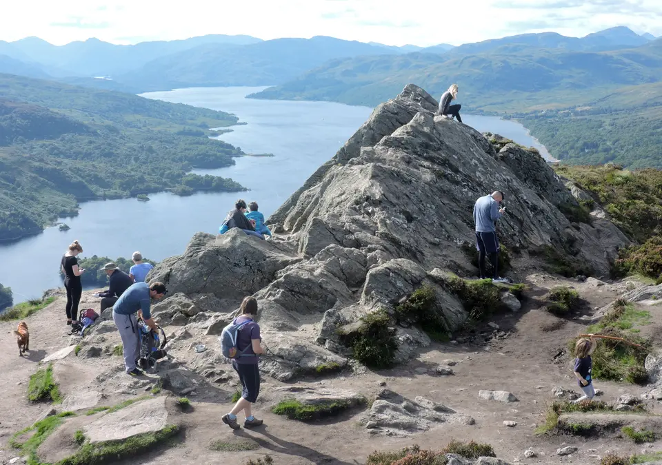

Ben A'an near Callander
Hill walk in the Trossachs, from the A821 at Loch Achray
Verdict
Go for a real summit and a wide view of Loch Katrine in half a day, if you are happy with a steep start and a rocky finish.
Skip if the top is in cloud or the rock is icy. If the car park is full, do not park on the road.
- Ben A'an car park. The start. Forestry and Land Scotland, on the A821 by Loch Achray. £5 all day.
- Ben A'an, 454 m. A small rocky summit with views over Loch Katrine and the surrounding hills.
- Distance, there and back
- c. 4 km
- Time
- 2–3 h
- Ascent
- 340 m
- Car park, all day
- £5
Today: 11°C and showers, sunset 18:21. Fine weekends are the busiest. Start early.
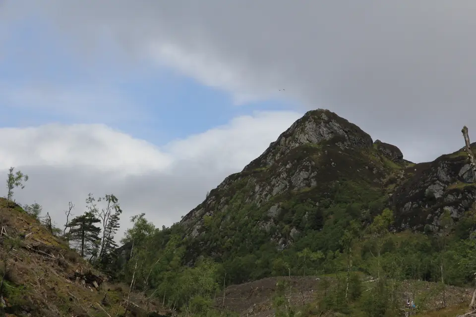
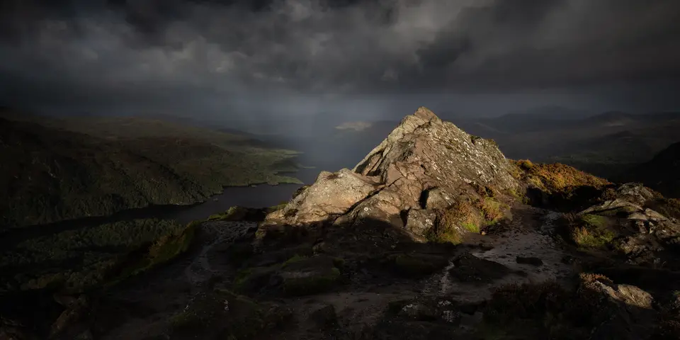
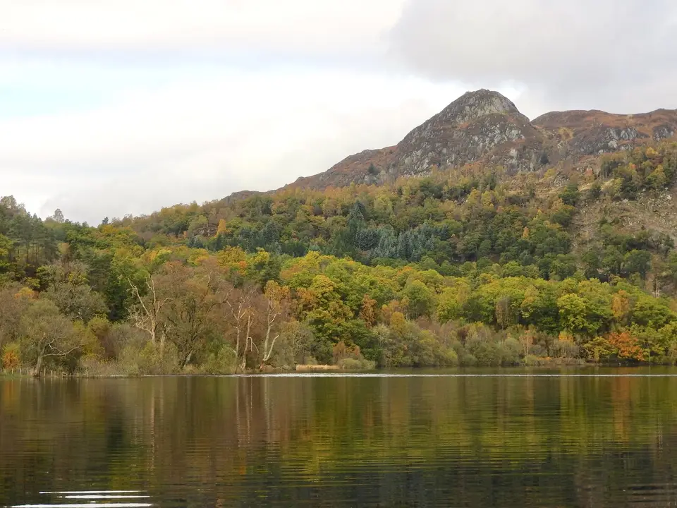
Ben A'an in photos



Is it for me?
Ben A'an near Callander is a walk of about 4 km there and back, taking 2 to 3 hours, with about 340 m of climbing to a summit at 454 m. It starts at the Forestry and Land Scotland car park on the A821 beside Loch Achray, in the Trossachs, a drive from Callander. The hill is small but the top is a proper rocky summit, with views over Loch Katrine and the hills around it. Choose a clear day, and check the the weather in each month before you set out.
- Beginners
- Yes, if you are reasonably fit and take your time: it is short, but the start is steep and the last section is rocky. Allow 2 to 3 hours.
- Children
- Suits children who are used to hill walking. The start is steep and the top has loose rock, so keep them close.
- Dogs
- We found no dog rules on the pages we read. The National Park says deer management and farming go on across the land, so keep dogs under close control and follow any signs.
- Buggies
- Not suited to buggies or wheelchairs: the path is steep and the summit section is rocky.
- Terrain
- A steep forest path that levels off, then a rocky final section to the top. In winter, snow and ice make it harder.
- Navigation
- Stay on the path. In cloud the top is harder to read, so turn back.
Map & height profile
- Ben A'an car park. The start. Forestry and Land Scotland, on the A821 by Loch Achray. £5 all day.
- Ben A'an, 454 m. A small rocky summit with views over Loch Katrine and the surrounding hills.
Map © OpenStreetMap contributors. Open in maps
| Step | Distance along route (km) | Height (m, approx.) |
|---|---|---|
| 1. The car park | 0 | 107 |
| 2. The steep forest section | 0.3 | 191 |
| 3. Levelling off | 0.7 | 255 |
| 4. The rocky final climb | 1.3 | 299 |
| 5. The summit | 1.7 | 421 |
Ben A'an summit weather
This is the forecast for the top of Ben A'an at 454 m, not for Ben A'an car park (Forestry and Land Scotland). Air cools by about 6.5°C for every 1,000 m you climb, so the summit is usually around 3°C colder than the loch shore, and the wind is often two or three times stronger. "Feels like" adds the wind chill. If the cloud base is below the summit you will walk in cloud, so take a map and compass.
| When | Weather | Temperature | Feels like | Wind | Summit in cloud |
|---|---|---|---|---|---|
| Today 12:00 | heavy showers | 9°C | 6°C | SW 13 mph | unlikely |
| Today 15:00 | heavy rain | 8°C | 5°C | SW 17 mph | possible |
| Tomorrow 09:00 | cloudy | 8°C | 5°C | S 13 mph | possible |
| Tomorrow 12:00 | light rain | 10°C | 10°C | SW 18 mph | possible |
| Tomorrow 15:00 | rain | 12°C | 12°C | S 19 mph | possible |
| Thursday 09:00 | cloudy | 8°C | 6°C | W 7 mph | unlikely |
| Thursday 12:00 | cloudy | 9°C | 7°C | SW 10 mph | unlikely |
| Thursday 15:00 | cloudy | 9°C | 7°C | SW 10 mph | unlikely |
Freezing level, midday estimate. Today: about 1,800 m. Tomorrow: about 2,000 m. Thursday: about 1,850 m.
Forecast for 454 m from MET Norway (yr.no), CC BY 4.0, with wind chill and freezing level worked out by us. Updated Tue 13 Oct, 10:30.
For a full mountain forecast, including the chance of cloud-free summits, see the MWIS Southern Highlands forecast.
The route, step by step
-
The car park
Park in the Forestry and Land Scotland car park on the A821 and cross the road with care to the signed path.
-
The steep forest section
The path starts steeply through forest. Settle into a steady pace: this is the hardest climbing of the walk.
-
Levelling off
The path levels off after a small bridge over a burn, and you can get your breath back before the top.
-
The rocky final climb
The ground steepens again and the path becomes rocky. Use your hands where you need to and take extra care if it is wet or icy.
-
The summit
The top gives views over Loch Katrine, Ben Venue and the hills around. Retrace your steps to the car park, and take the downhill slowly on the rocks.
Parking & getting there
Ben A'an car park (Forestry and Land Scotland)
- Where
- On the A821 beside Loch Achray, reached over the Duke's Pass from Aberfoyle. Postcode FK17 8HY.
- Operator
- Forestry and Land Scotland, charged parking
- Price
- £2 up to 1 hour; £5 all day; £14 minibus or coach all day. Blue Badge holders park free. The walk takes longer than an hour, so plan on the all-day rate.
- Payment
- Coins, card or RingGo. Annual passes are available.
- Toilets
- None at the car park. The nearest public toilets, shops and food are at Trossachs Pier on Loch Katrine.
- Busy times
- Arrive early on a fine weekend. If the car park is full, do not park on the road.
Last checked 13 Oct 2026
Car-free
The Trossachs Explorer bus serves the A821 from Aberfoyle and Callander. Stirling Council relaunched it on 29 June 2026 as a year-round service with four return journeys a day. Check Traveline Scotland for the stop and the last bus home. For the wider picture, see travel from Glasgow and Edinburgh.
When it is busy
Editorial estimate of a typical summer day, on the path and at the start. These are not measured counts.
| Day | 8:00 | 9:00 | 10:00 | 11:00 | 12:00 | 13:00 | 14:00 | 15:00 | 16:00 |
|---|---|---|---|---|---|---|---|---|---|
| Weekday | Quiet | Quiet | Steady | Steady | Steady | Steady | Steady | Quiet | Quiet |
| Saturday | Quiet | Steady | Busy | Busy | Busy | Busy | Busy | Busy | Steady |
| Sunday | Quiet | Steady | Busy | Busy | Busy | Busy | Busy | Steady | Quiet |
Q QuietS SteadyB BusyF Car park full
Tip: start early on a fine weekend, or go on a weekday.
Call it off if
- The top is in cloud: there is no view and the rock is harder to read.
- The rock or the path is icy or snowy and you do not have grippy boots.
- The car park is full: do not park on the road, as it blocks other traffic. Pick another walk.
- It is late in the day: allow 2 to 3 hours and keep daylight to spare.
Make a day of it
Morning
Beat the crowds
- Early Park at Loch Achray and set off up the forest path.
- +2–3 h Back down within the 2 to 3 hours the walk takes. Allow longer for photos at the top.
Midday
Lunch by Loch Katrine
- Midday The nearest public toilets, shops and food are at Trossachs Pier. The Loch Katrine guide covers the loch and its pier.
- Pier Check the Trossachs Pier guide for what is open before you drive over.
Afternoon
A bigger hill
- Afternoon For a long day on foot, Ben Venue starts from a car park on the same road.
- Evening Look at a base in Callander, or the Callander parking guide if you are leaving the car in town.
Where to stay near Ben A'an
Partner links: we may earn a commission
Questions people ask
How long does it take to climb Ben A'an?
Allow 2 to 3 hours for the round trip, which is about 4 km with about 340 m of climbing. Add time for photos at the top.
Is Ben A'an difficult?
It is short but not easy: the start is steep through forest, and the last section is rocky. The National Park describes it as rarely taxing, though a little steep in places. Take care in winter snow and ice.
Is Ben A'an a Corbett?
No. At 454 m it is a small hill, well below the height a Corbett needs. It is popular because the summit feels like a mountain's.
Where is the car park for Ben A'an located?
It is on the A821 beside Loch Achray, in the Trossachs, with the postcode FK17 8HY. Forestry and Land Scotland runs it: £2 up to 1 hour, £5 all day, and Blue Badge holders park free.
How high is Ben A'an?
The summit is 454 m above sea level. The walk climbs about 340 m from the car park.
Can I park for free at Ben A'an?
Only if you hold a Blue Badge. Otherwise it is £2 for up to 1 hour or £5 all day, which is the rate the walk needs. Pay with coins, card or RingGo.
Are there toilets at the Ben A'an car park?
No. The nearest public toilets, shops and places to eat are at Trossachs Pier on Loch Katrine.
Can I get to Ben A'an without a car?
The Trossachs Explorer bus serves the A821 from Aberfoyle and Callander. Check Traveline Scotland for the stop and the last bus home.
Where can I stay near Ben A'an?
The nearest town with a choice of beds is Callander. Browse Callander accommodation for the options.
Nearby
- Same roadBen VenueA longer hill day from a car park beside Loch Achray.
- Another walkGreat Trossachs PathA long route through the Trossachs, with its own route guide.
- Close byLoch KatrineThe loch you see from the summit, with a pier and boat trips.
- All walksMore walks around the lochEvery walk guide on the site, with distances and times.
- Nearest townCallanderThe town for food, beds and the walk's wider area.