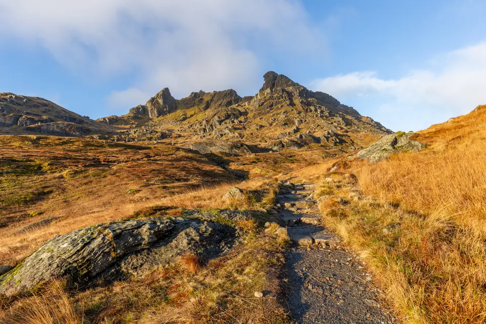

The Cobbler from Arrochar
Hill walk from Arrochar, at the head of Loch Long
Verdict
Go for a Corbett with a real rock summit, on a clear day, if you are a confident hill walker.
Skip in cloud, strong wind or ice, or if you do not want any scrambling. The ridge and the views are worth it even if you stop below the final pinnacle.
- Succoth car park. The start, off the A83 just west of Arrochar. Check the machine for today's tariff.
- The Cobbler, about 884 m. The top of the central peak. The true summit is a rock pinnacle that needs a scramble.
- Return, about
- 11 km
- Time, about
- 4–6 h
- Ascent, about
- 920 m
- Our grade
- Hard
Today: 10°C and rain, sunset 18:23. Fine weekends are the busiest and the car park fills. Start early.
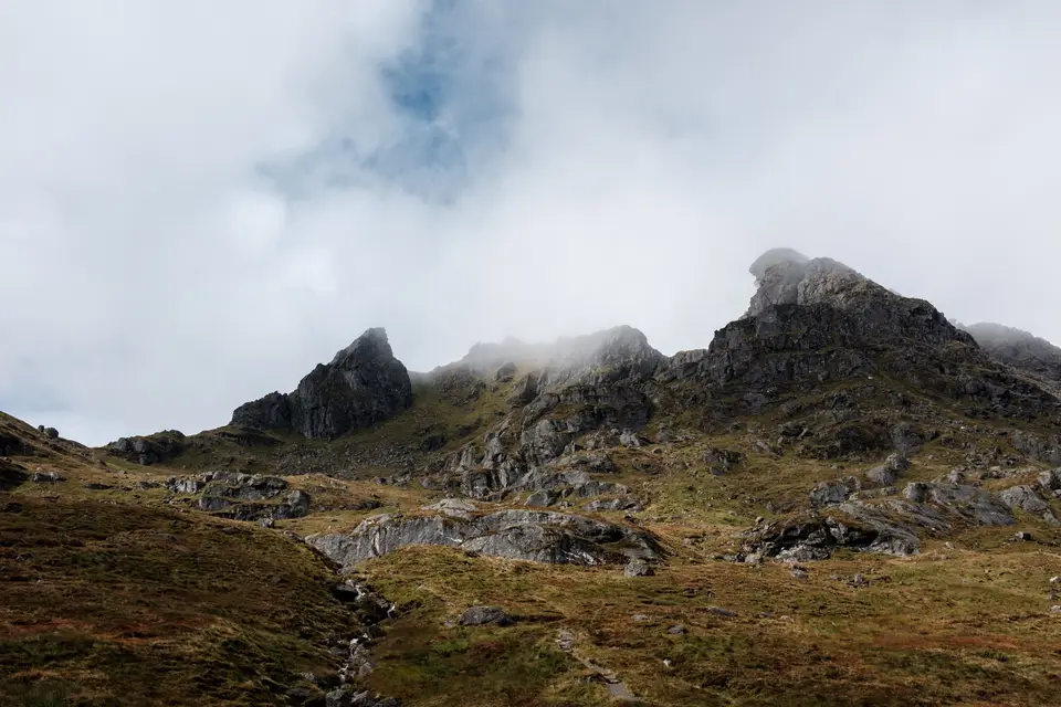
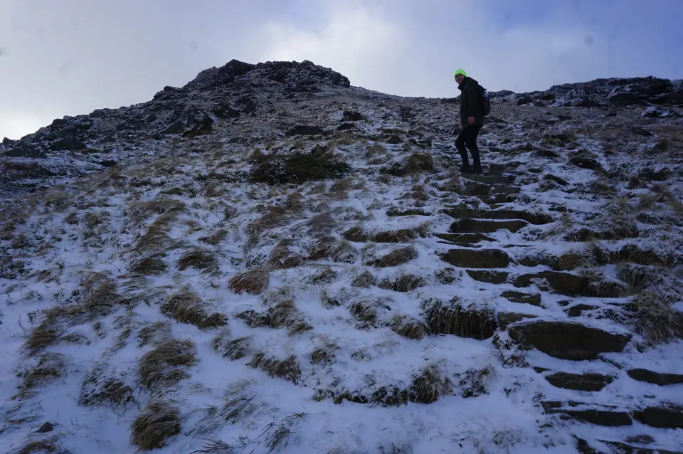
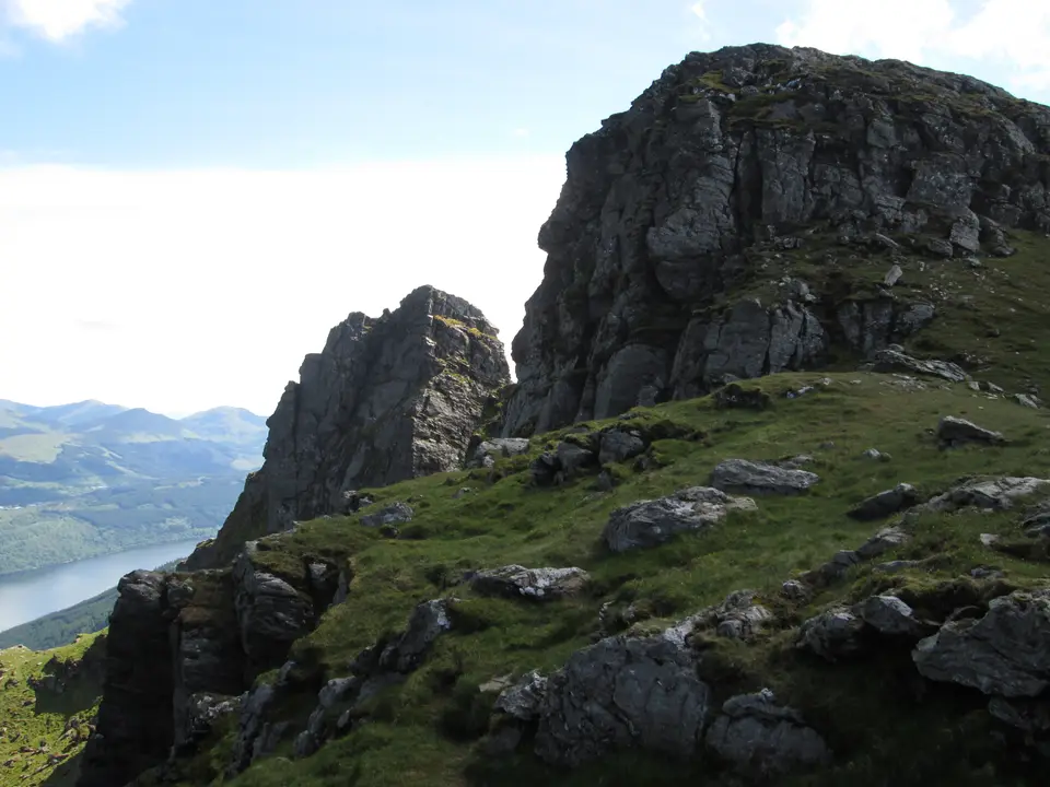
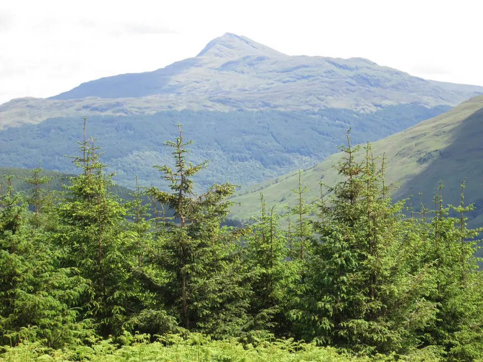
The Cobbler in photos
_by_Chris_Collins.jpg)



Is the Cobbler for me?
The Cobbler from Arrochar is a hard hill day: about 11 km, 4 to 6 hours and about 920 m of climbing from the car park at Succoth. It is a Corbett, not a Munro, and its three rock peaks make the most distinctive skyline in the Arrochar Alps. The path is good for most of the way, but the highest point is a rock pinnacle that needs a scramble with a big drop beside you. Start from Arrochar at the head of Loch Long and check the weather and best time to go before you set out.
- Beginners
- Not for a first hill. It is a long day on steep, rocky ground. Choose something shorter to build up to it.
- Is it a Munro?
- No. The Cobbler is a Corbett, a hill between 2,500 and 3,000 feet. The Munros beside it are Beinn Narnain and Beinn Ime.
- Time
- Allow 4 to 6 hours for the round trip, and longer with stops on the top.
- Terrain
- A good path with many stone steps for most of the way, then steep rocky ground. The quicker descent is looser and rougher.
- The pinnacle
- The true summit is a rock pinnacle. Reaching it means a scramble through a hole in the rock and along a sloping ledge with a big drop, and you must be able to climb back down. Many walkers stop on the plateau below it.
- Stalking
- The Cobbler and Beinn Narnain are on land managed by Forestry and Land Scotland, and the walk guide we checked reports no stalking issues. Look for notices on the day.
- Dogs
- A fit dog can manage the path, but the steps, rock and scramble are hard on them. Keep dogs close.
- Navigation
- The main path is clear in good weather. In cloud the ridge is hard to read, so carry a map and compass and know how to use them.
Map & height profile
- Succoth car park. The start, off the A83 just west of Arrochar. Check the machine for today's tariff.
- The Cobbler, about 884 m. The top of the central peak. The true summit is a rock pinnacle that needs a scramble.
Map © OpenStreetMap contributors. Open in maps
| Step | Distance along route (km) | Height (m, approx.) |
|---|---|---|
| 1. Succoth car park | 0 | 14 |
| 2. Zig-zags through the forest | 1 | 103 |
| 3. The stream and the hydro dam | 2.4 | 299 |
| 4. The Narnain Boulders | 3.9 | 504 |
| 5. The steps to the ridge | 4.6 | 625 |
| 6. The central peak | 5.3 | 843 |
The Cobbler summit weather
This is the forecast for the top of the Cobbler at 884 m, not for Succoth car park, off the A83 (Arrochar). Air cools by about 6.5°C for every 1,000 m you climb, so the summit is usually around 6°C colder than the loch shore, and the wind is often two or three times stronger. "Feels like" adds the wind chill. If the cloud base is below the summit you will walk in cloud, so take a map and compass.
| When | Weather | Temperature | Feels like | Wind | Summit in cloud |
|---|---|---|---|---|---|
| Today 12:00 | heavy rain | 6°C | 2°C | SW 11 mph | possible |
| Today 15:00 | heavy rain | 4°C | 0°C | W 16 mph | possible |
| Tomorrow 09:00 | rain | 6°C | 2°C | S 13 mph | likely |
| Tomorrow 12:00 | light rain | 7°C | 4°C | S 16 mph | likely |
| Tomorrow 15:00 | rain | 8°C | 5°C | S 18 mph | possible |
| Thursday 09:00 | cloudy | 5°C | 3°C | W 8 mph | unlikely |
| Thursday 12:00 | cloudy | 6°C | 3°C | SW 10 mph | unlikely |
| Thursday 15:00 | cloudy | 6°C | 3°C | SW 10 mph | unlikely |
Freezing level, midday estimate. Today: about 1,750 m. Tomorrow: about 2,000 m. Thursday: about 1,800 m.
Forecast for 884 m from MET Norway (yr.no), CC BY 4.0, with wind chill and freezing level worked out by us. Updated Tue 13 Oct, 10:30.
For a full mountain forecast, including the chance of cloud-free summits, see the MWIS Southern Highlands forecast.
The route, step by step
-
Succoth car park
Park in the large car park off the A83 at Succoth. The path starts on the opposite side of the road, and the walk is waymarked in red (vaguely, so keep your eyes open).
-
Zig-zags through the forest
A wide path climbs through the trees in easy zig-zags, with views opening up over Loch Long. Do not cut the bends, as that causes erosion. At a bench turn left onto the forestry track, then very soon right up the next section of path.
-
The stream and the hydro dam
After a short forest section the path comes out beside a stream. Keep straight on where a path leads off to the right, and follow the stream upstream past a small hydro dam. The three peaks of the Cobbler come into view ahead.
-
The Narnain Boulders
The path crosses side streams on large stepping stones and reaches the Narnain Boulders, huge rocks that climbers once used as sleeping shelters. At a fork keep right and carry on up the valley. The lower path on the left is the way back.
-
The steps to the ridge
Near a small lochan the paths split. The right-hand path leads to Beinn Ime and Beinn Narnain. For the Cobbler turn left up many stone steps. The path is less well made near the top but still easy to follow, and it reaches the ridge between the north and central peaks.
-
The central peak
Turn right for the higher, central peak. A small plateau gives views in every direction, and the pinnacle that marks the true summit stands beside it. If you also want the north peak, go back to the ridge and keep left around its northern side: it is a dramatic spot above an overhang, with a great view of the hole through the central peak. To come down, retrace your steps, or take the quicker, rougher path south-east that starts with easy stone steps. It turns loose and rocky, with a simple scramble down a gully, before it rejoins the main path.
Parking & getting there
Succoth car park, off the A83 (Arrochar)
- Where
- The large car park off the A83 at Succoth, just west of Arrochar. Grid ref NN294048.
- Charge
- Argyll and Bute Council's 2026/27 tariff for Arrochar Glenloin is £1.20 an hour or £10.30 a day, pay and display, Monday to Sunday 9am to 6pm. The council pages do not use the name Succoth, so check the machine and signs.
- Spaces
- The council lists 58 spaces at its Glenloin No 2 car park. Check the signs to see which car park you are in.
- Overnight
- The council's Glenloin car park does not allow overnight or motorhome parking. Check the signs at Succoth.
- Busy times
- Arrive early on a fine weekend. If the car park is full, the Arrochar parking guide lists the other places to leave a car.
Last checked 13 Oct 2026
Car-free
Walkhighlands lists Citylink buses to Arrochar and local buses to Arrochar and Succoth as the options for the start. The West Highland line serves Arrochar & Tarbet, and bus 302 (Garelochhead Coaches) calls at Arrochar. We have no verified times for the local bus to Succoth, so check Traveline Scotland, and look hard at the last journey home: the walk takes 4 to 6 hours. For the wider picture, see getting to Loch Lomond.
When it is busy
Editorial estimate of a typical summer day, on the path and in the car park. These are not measured counts.
| Day | 7:00 | 8:00 | 9:00 | 10:00 | 11:00 | 12:00 | 13:00 | 14:00 | 15:00 |
|---|---|---|---|---|---|---|---|---|---|
| Weekday | Quiet | Quiet | Steady | Steady | Steady | Steady | Steady | Steady | Quiet |
| Saturday | Quiet | Steady | Busy | Busy | Busy | Busy | Busy | Busy | Steady |
| Sunday | Quiet | Steady | Busy | Busy | Busy | Busy | Busy | Steady | Quiet |
Q QuietS SteadyB BusyF Car park full
Tip: start early on a fine weekend. The walk takes 4 to 6 hours and the car park fills, so an early start gives you both a space and spare daylight.
Call it off if
- The top is in cloud: the ridge is hard to read and the views are the point.
- Strong wind is forecast: the ridge and the pinnacle are exposed.
- The steps or rock are wet, icy or snowy and you do not have winter kit and the skills to use it.
- You are not happy scrambling with a big drop beside you: stop on the plateau and enjoy the view.
- It is getting late: the walk takes 4 to 6 hours, so keep daylight to spare, especially in autumn and winter.
Make a day of it
Morning
The hill
- Early Park at Succoth and set off before the car park fills.
- +4–6 h Allow 4 to 6 hours for the round trip, and longer with stops on the top.
Afternoon
A bed nearby
- After Staying the night? Arrochar hotels and B&Bs make the easiest base for an early start.
- Camping Pitching a tent? Check the camping permit rules first: permits apply in the National Park's camping zones from 1 March to 30 September.
Another day
More hills and water
- Across the loch Looking over the water, Ben Lomond is the big hill on the east shore.
- Lower For a gentler day on foot, the Three Lochs Way passes through Arrochar, and Loch Long fills the view from the road.
Where to stay near the Cobbler
Partner links: we may earn a commission
See the walk first
Video: Donna & Elliot's Adventures on YouTube. Watch on YouTube
Questions people ask
How long does a cobbler take to climb?
About 4 to 6 hours for the round trip from Succoth car park, covering about 11 km with about 920 m of climbing. Allow longer if you stop on the top or take your time on the steps.
Is cobbler a Munro?
No. The Cobbler (Ben Arthur) is a Corbett, a hill of 2,500 to 3,000 feet. The Munros next to it are Beinn Narnain and Beinn Ime, which are also reached from the Arrochar forest car park.
How high is the Cobbler?
About 884 m. Published heights differ by a few metres, and the central peak is the highest of its three tops.
Where do you park for the Cobbler?
In the large car park off the A83 at Succoth, just west of Arrochar (grid ref NN294048). Argyll and Bute Council's 2026/27 tariff for Arrochar Glenloin is £1.20 an hour or £10.30 a day, but the council pages do not use the name Succoth, so check the machine.
How hard is the Cobbler?
Hard, by our grade. The path is good and has many stone steps, but the day is long, the ground is steep and rocky, and the descent is rougher. The summit pinnacle is a scramble with a big drop.
Do you have to scramble to reach the top of the Cobbler?
Only for the true summit. The pinnacle is reached by scrambling through a hole in the rock and along a sloping ledge, and you must be able to climb back down. The plateau of the central peak and the north peak are walks.
Can I get to the Cobbler without a car?
Yes. Citylink buses and local buses run to Arrochar, and the West Highland line has a station at Arrochar & Tarbet. We have no verified times for the local bus to Succoth, so check Traveline Scotland and plan the last journey home.
Can I take my dog up the Cobbler?
A fit dog can do the path, but the stone steps, rocky ground and scramble are hard on dogs. Keep your dog close and be ready to stop below the pinnacle.
Nearby
- Across Loch LomondBen LomondThe big hill on the east shore, with its own route guide.
- A longer routeThree Lochs WayThe long-distance route that passes through Arrochar.
- At the foot of the hillLoch LongThe sea loch at the head of which Arrochar sits.
- RelatedAll walksMore routes around the loch, from short strolls to hill days.