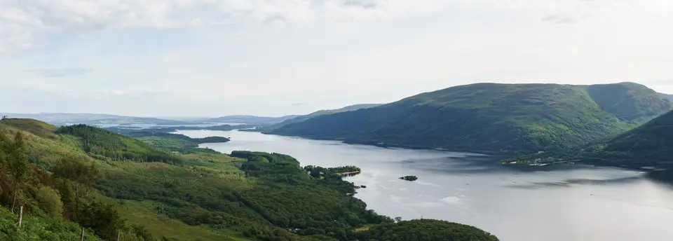

Ben Lomond
Walk from Rowardennan, on the east shore
Verdict
Go if you are hill-fit, have proper kit and can start early on a clear day.
Skip in cloud, high wind or ice, or if you expect a gentle stroll. This is a long mountain day, not a short walk.
- Rowardennan car park. The start. Forestry and Land Scotland pay and display; £5 all day.
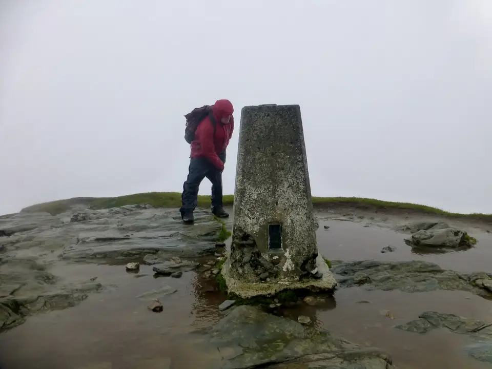
- Ben Lomond, 974 m. The summit and trig point: the most southerly Munro.
- Distance
- 12 km
- Time
- 4.5–5.5 h
- Ascent
- 990 m
- Summit
- 974 m
Fine summer weekends are the busiest. Start early.
Ben Lomond in photos





Is it for me?
Ben Lomond is the most southerly Munro: a 12 km round trip of 4.5 to 5.5 hours from Rowardennan car park, with about 990 m of climbing to a 974 m summit. It is a long day, not a short stroll. The walk starts in Rowardennan on the east shore, and if you want a bed the night before, see where to stay in Rowardennan. Choose a clear day, and check the best months to come before you set out.
- Beginners
- Not a first hill. The Tourist Path is well laid, but the climb is about 990 m, so it suits walkers who are hill-fit and used to long days.
- Children
- Only for children used to long hill days: 12 km and 990 m of climbing is a lot for small legs.
- Dogs
- Keep dogs close and on a lead near sheep or ground-nesting birds. Carry water for them, as there is none high up.
- Buggies
- Not suited to buggies or wheelchairs: this is a mountain path, rocky in places.
- Terrain
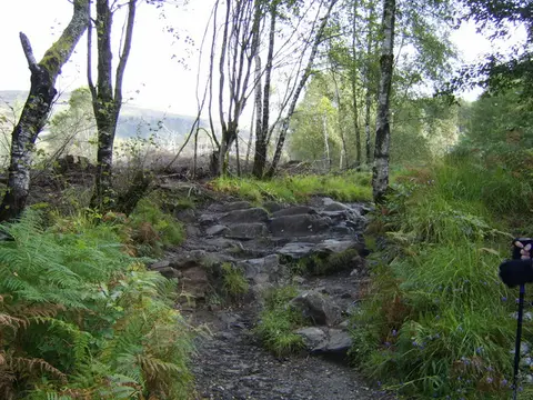
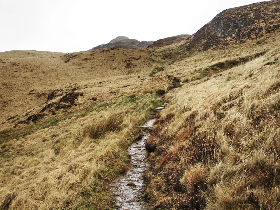
- A well-laid path, rougher and steeper as you gain height. The Ptarmigan Ridge circuit is the alternative to the Tourist Path.
- Navigation
- In cloud the top is hard to read and the ground falls away. Carry a map and compass and know how to use them, or turn back.
Map & height profile
- Rowardennan car park. The start. Forestry and Land Scotland pay and display; £5 all day.
- Ben Lomond, 974 m. The summit and trig point: the most southerly Munro.
Map © OpenStreetMap contributors. Open in maps
| Step | Distance along route (km) | Height (m, approx.) |
|---|---|---|
| 1. Rowardennan car park | 0 | 20 |
| 2. Up from the loch | 1 | 152 |
| 3. The long middle | 3 | 550 |
| 4. The upper slopes | 5 | 780 |
| 5. The top | 6 | 933 |
The Tourist Path, step by step
-
Rowardennan car park
Start at Rowardennan car park and pick up the signed Ben Lomond path. The toilets are open from Easter to October.
-
Up from the loch
The path climbs steadily from the shore. Settle into a pace you can hold for hours rather than racing the first kilometre.
-
The long middle
The climb never really flattens. This is where a late start shows, so decide your turn-round time here and keep to it.
-
The upper slopes
The path steepens and gets rougher. Take extra care if it is wet or icy, and put on a layer before the wind finds you.
-
The top
Reach the trig point at 974 m. Retrace your steps to Rowardennan, or, if the weather is clear and you are confident on steep ground, come down by the Ptarmigan Ridge circuit.
Parking & getting there
Rowardennan car park (Forestry and Land Scotland)
- Where
- Rowardennan, start of the walk. Grid ref NS359986, postcode G63 0AR
- Operator
- Forestry and Land Scotland (Queen Elizabeth Forest Park)
- Price
- £2 up to 1 hour; £5 all day; £14 for a minibus or coach all day; Blue Badge holders free. Check the machine.
- Payment
- Coins, card or RingGo; annual passes are available
- Toilets
- Public and accessible toilets, open Easter to October
- Overnight and EV
- Not stated by the operator. Ask Forestry and Land Scotland before planning to stay overnight or charge a car.
- Busy times
- Arrive early on a fine weekend. Full details are in the Rowardennan parking guide.
Last checked 12 Oct 2026
Car-free
No bus runs to Rowardennan. By public transport, take a coach or train to Tarbet (about 1 hour from Glasgow), then the summer waterbus across the loch. Check Traveline Scotland and the waterbus times before you go, especially for the last journey home. For the wider picture, see getting to Loch Lomond without a car.
When it is busy
Editorial estimate of a typical summer day, on the path and in the car park. These are not measured counts.
| Day | 8:00 | 9:00 | 10:00 | 11:00 | 12:00 | 13:00 | 14:00 | 15:00 | 16:00 |
|---|---|---|---|---|---|---|---|---|---|
| Weekday | Quiet | Quiet | Steady | Steady | Steady | Steady | Steady | Quiet | Quiet |
| Saturday | Quiet | Steady | Busy | Busy | Busy | Busy | Busy | Steady | Steady |
| Sunday | Quiet | Steady | Busy | Busy | Busy | Busy | Busy | Steady | Quiet |
Q QuietS SteadyB BusyF Car park full
Tip: start before 9:00 on a summer weekend. It is a 4.5 to 5.5 hour walk, so a late start means coming down tired.
Call it off if
- The top is in cloud: there is no view, the summit is hard to read and the ground falls away.
- Strong wind is forecast: the upper slopes and summit are exposed.
- There is ice or snow and you do not have the kit and skills for winter hill walking.
- It is late in the day: allow 4.5 to 5.5 hours plus stops and keep daylight to spare.
- You are behind your turn-round time or the weather has changed. Turning back is part of hill walking. In an emergency call 999 and ask for Mountain Rescue.
Make a day of it
Early start
The whole hill
- By 9:00 Park at Rowardennan and set off up the Tourist Path.
- +4.5–5.5 h Back at the car park within the 4.5 to 5.5 hours the walk takes. Allow longer for the top and a rest.
Cloud on the top
A lower day
- Morning Skip the summit and spend the day by the water instead: what to expect at Loch Long.
- Anytime For gentler walking, browse all the walks or the places around the loch.
Staying out
Camping
- Before you go Camping rules in the National Park differ by area and season. Read the guide to camping permits before you bring a tent.
- Evening Do not plan to camp by the car park without checking: overnight stays there are not confirmed.
Where to stay near Rowardennan
Partner links: we may earn a commission
Questions people ask
Is Ben Lomond a hard walk?
It is a hard day rather than a technical one. The Tourist Path is well laid, but the walk is 12 km, climbs about 990 m and takes 4.5 to 5.5 hours.
Which is the most southerly Munro in Scotland?
Ben Lomond, at 974 m. It stands on the east shore of Loch Lomond.
How long does it take to walk Ben Lomond?
Allow 4.5 to 5.5 hours for the round trip by the Tourist Path, plus time for a rest and the view.
Where do you park for Ben Lomond?
At Rowardennan car park (postcode G63 0AR), run by Forestry and Land Scotland. It is £5 all day or £2 up to an hour. Pay by coins, card or RingGo.
Is there a map of the walks around Loch Lomond?
Yes: the map on this page shows the Tourist Path from Rowardennan to the summit. For other routes, see the walks guides.
What is the nicest part of Loch Lomond?
That is a matter of taste. As an editorial opinion, the loch looks its best from height, so a clear day on Ben Lomond is hard to beat. For a gentler day, browse the villages and places around the loch.
What is the Ptarmigan Ridge route?
It is a circuit up Ben Lomond that the National Park lists as the alternative to the Tourist Path. Use it only when the weather is clear and you are confident on steep ground.
Can you get to Ben Lomond without a car?
Yes, with planning. Take a coach or train to Tarbet, then the summer waterbus to Rowardennan. Check the times first, especially the last waterbus home.
Can I camp near Ben Lomond?
Rules differ by area and season in the National Park, so read the camping permit guide before bringing a tent.
Nearby
- Long-distance routeWest Highland WayThe long-distance path passes the foot of the hill at Rowardennan.
- A quieter long routeThree Lochs WayA 50 km path from Balloch to Inveruglas: see how to walk the Three Lochs Way.
- Another walkLoch Lomond Faerie TrailA gentler walk with its own route guide.