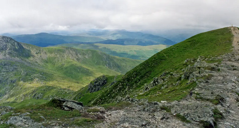

Ben Vorlich (Loch Earn)
Munro walk from Ardvorlich, on the south side of Loch Earn
Verdict
Go for a first Munro on a clear path from Loch Earn, with a long view over the edge of the Highlands. Pick a clear day.
Skip if the top is in cloud, you are not ready for about 870 m of climbing, or you meant the other Ben Vorlich, above Loch Lomond.
- Ardvorlich, the start. Park on the verges of the minor road along the south side of Loch Earn, and walk up the estate track.
- Ben Vorlich, 985 m. A Munro with a trig point on the summit. The view stretches over central Scotland.
- Distance
- ~10 km
- Time
- 4.5–6 h
- Ascent
- ~870 m
- Parking
- Roadside
Today: 11°C and showers, sunset 18:20. Roadside spaces are limited. Arrive early.
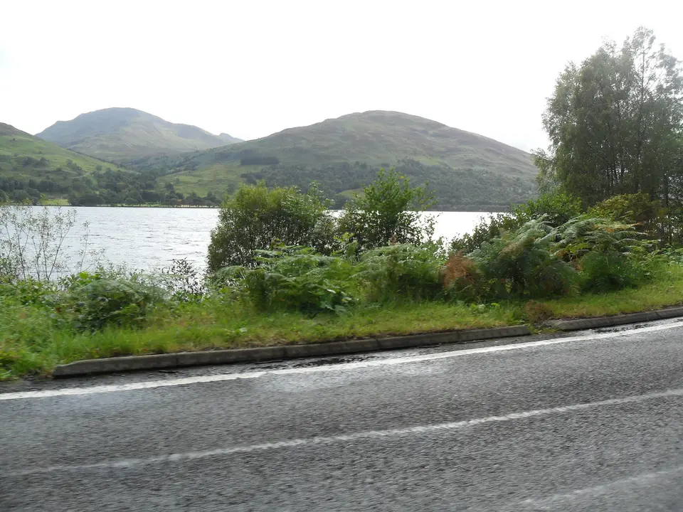
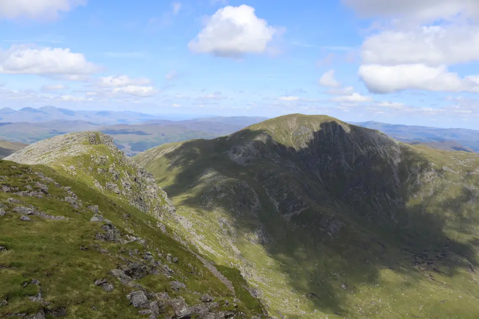
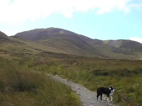
Ben Vorlich in photos



Is it for me?
Ben Vorlich (Loch Earn) is a 985 m Munro, and the walk from Ardvorlich is about 10 km with about 870 m of climbing, taking 4.5 to 6 hours. The path is clear and the hill is a common first Munro, but it is still a big day. You start on the minor road on the south side of Loch Earn, further along the loch from Lochearnhead. The route figures are from published route logs, because no official figure is published, so allow a margin. Two Munros share this name, so if you meant the one above Loch Lomond, jump to the section on the other Ben Vorlich below. Check the best time to visit before you go.
- Beginners
- A common first Munro, with a clear path and straightforward hillwalking. It is still 4.5 to 6 hours and about 870 m of climbing, so carry hill gear and food.
- Children
- Children who already walk for hours have done it, but the last climb to the summit ridge is steep and eroded. Judge on stamina, not age.
- Dogs
- Keep dogs close and on a lead near livestock. During the stalking season, avoid disturbing deer and check with the estate.
- Buggies
- Not suited to buggies or wheelchairs: the path becomes eroded and steep on the hill.
- Terrain
- Estate track, then a path across open heather that becomes eroded up the ridge to a final steeper climb. Boggy in places (bog factor 4 out of 5).
- Stalking
- Ardvorlich Estate stalks between mid-September and 20 October. Walkhighlands says access by the main paths and ridges is always fine; the estate number is 01764 685260.
- Stùc a' Chròin
- The second Munro is rockier and trickier, with some slight scrambling. With both hills the route is about 14.5 km, about 1145 m of climbing and 6 to 7 hours. Winter conditions need expert skills.
Looking for the other Ben Vorlich?
Two Munros are called Ben Vorlich. This page covers the one above Loch Earn, at 985 m, which is the one most people search for. The other Ben Vorlich, at 943 m, rises on the west side of the head of Loch Lomond, above Ardlui and Inveruglas.
The Loch Lomond hill is a separate day. The National Park lists three starts: Ardlui, Arrochar and Tarbet station, and Inveruglas by the Loch Sloy dam road. Walkhighlands calls it a tough ascent despite its closeness to the road, and the park notes active deer management and farming on the land. Plan it on its own, not as a swap for the Loch Earn walk. For the Inveruglas end, see the Inveruglas guide, and for the village at the foot of the nearby hills see Arrochar.
A quick check before you drive: the Loch Earn hill is reached from the minor road south of Loch Earn near Ardvorlich, and the Loch Lomond hill is reached from the A82 at the head of the loch. If your satnav says Ardlui, Tarbet or Inveruglas, you are heading for the Loch Lomond one.
Map of the walk
- Ardvorlich, the start. Park on the verges of the minor road along the south side of Loch Earn, and walk up the estate track.
- Ben Vorlich, 985 m. A Munro with a trig point on the summit. The view stretches over central Scotland.
Map © OpenStreetMap contributors. Open in maps
Ben Vorlich summit weather
This is the forecast for the top of Ben Vorlich at 985 m, not for Ardvorlich roadside parking, Loch Earn. Air cools by about 6.5°C for every 1,000 m you climb, so the summit is usually around 6°C colder than the loch shore, and the wind is often two or three times stronger. "Feels like" adds the wind chill. If the cloud base is below the summit you will walk in cloud, so take a map and compass.
| When | Weather | Temperature | Feels like | Wind | Summit in cloud |
|---|---|---|---|---|---|
| Today 12:00 | showers | 6°C | 1°C | SW 15 mph | unlikely |
| Today 15:00 | heavy rain | 5°C | 1°C | SW 17 mph | possible |
| Tomorrow 09:00 | cloudy | 5°C | 1°C | S 11 mph | possible |
| Tomorrow 12:00 | light rain | 7°C | 3°C | SW 17 mph | possible |
| Tomorrow 15:00 | rain | 8°C | 4°C | SW 20 mph | possible |
| Thursday 09:00 | cloudy | 5°C | 2°C | W 7 mph | unlikely |
| Thursday 12:00 | cloudy | 6°C | 3°C | SW 10 mph | unlikely |
| Thursday 15:00 | cloudy | 6°C | 3°C | SW 10 mph | unlikely |
Freezing level, midday estimate. Today: about 1,850 m. Tomorrow: about 2,050 m. Thursday: about 1,900 m.
Forecast for 985 m from MET Norway (yr.no), CC BY 4.0, with wind chill and freezing level worked out by us. Updated Tue 13 Oct, 10:30.
For a full mountain forecast, including the chance of cloud-free summits, see the MWIS Southern Highlands forecast.
The route, step by step
-
Ardvorlich
Park on the verges of the minor road on the south side of Loch Earn, mostly west of the hump-backed bridge over the Ardvorlich burn. Start up the track on the east side of the burn, between the urn-topped stone gateposts.
-
Farm cottages and the bridge
Keep right at the fork below the farm cottages and cross the bridge back to the west side of the burn. Ardvorlich House is ahead. Turn left once you are over the bridge.
-
Track to the footbridge
The track passes over stiles beside several gates. After about a kilometre and a half it forks: take the main route to the right. A little further on, cross the Allt a' Choire Bhuidhe on a footbridge. Here the track ends and the route becomes a path.
-
Open heather and the ridge
The first part of the path has been improved in recent years. It climbs across open heather towards the north side of the hill, then becomes increasingly eroded as it climbs the Sgiath nam Tarmachan ridge, the wings of the ptarmigan.
-
The summit
A final steeper climb leads half left to the summit ridge. The trig point is at 985 m, and the cairn a little further east is slightly lower. The position on the southern edge of the Highlands makes it a fine viewpoint over central Scotland. Most walkers return the same way.
-
Optional: Stùc a' Chròin
Experienced hill walkers can follow the ridge west and then down to the bealach for Stùc a' Chròin, a much rockier and trickier peak. There is a bypass route in summer, but the section is for expert mountaineers in winter.
Parking & getting there
Ardvorlich roadside parking, Loch Earn
- Where
- Ardvorlich, on the minor road along the south side of Loch Earn. Grid ref NN633232.
- Surface
- Rough, informal parking on the verges, mostly west of the hump-backed bridge over the Ardvorlich burn.
- Price
- None of the sources we read lists a charge or a ticket machine. Check any signs at the verge.
- Busy times
- Space is limited. Arrive early and park tidily without blocking the road or gates.
- Toilets
- None listed at the start. Plan a stop in Lochearnhead before you set off.
- Stalking
- Ardvorlich Estate stalks between mid-September and 20 October. Main paths and ridges are always fine to use.
Last checked 13 Oct 2026
Car-free
No public transport reaches the start. Buses run to Lochearnhead and St Fillans, but we have not checked the walk along the minor road from either, so treat that as a long extra. Check Traveline Scotland for times. For parking elsewhere in the park, see the car parks around the loch.
When it is busy
Editorial estimate of a typical summer day, on the path and at the start. These are not measured counts.
| Day | 8:00 | 9:00 | 10:00 | 11:00 | 12:00 | 13:00 | 14:00 | 15:00 | 16:00 |
|---|---|---|---|---|---|---|---|---|---|
| Weekday | Quiet | Quiet | Steady | Steady | Steady | Steady | Steady | Steady | Quiet |
| Saturday | Quiet | Steady | Busy | Busy | Busy | Busy | Busy | Busy | Steady |
| Sunday | Quiet | Steady | Busy | Busy | Busy | Busy | Busy | Steady | Quiet |
Q QuietS SteadyB BusyF Car park full
Tip: start by 9am on a fine weekend, as roadside space is limited.
Call it off if
- The top is in cloud: the view is the point, and the summit ridge is harder to read.
- Strong wind is forecast: the summit ridge is exposed.
- There is snow or ice on the ridge and you do not have winter equipment and skills.
- It is late in the day: allow 4.5 to 6 hours and keep daylight to spare.
- You are heading for Stùc a' Chròin in poor weather or in winter: the rocky section needs expert skills.
Make a day of it
Morning
Up the hill
- Early Park at Ardvorlich on the verge and set off up the estate track.
- +4.5–6 h Back at the road, with daylight to spare. Add time for the summit view.
Midday
On the water
- After Loch Earn has fishing, sailing, water-skiing, wake-boarding and canoeing, for a lighter second half to the day.
- Castle Edinample Castle, built in 1630, is about 1 km south of Lochearnhead.
Afternoon
Another hill
- Option For a gentler second day, see the Ben Ledi walk in the Trossachs, or more walks around the park.
Where to stay near Ben Vorlich
Partner links: we may earn a commission
Questions people ask
How long does it take to climb Ben Vorlich Loch earn?
Allow 4.5 to 6 hours for the round trip of about 10 km from Ardvorlich, with about 870 m of climbing. Published logs range from just over 4 hours to nearly 6, depending on pace.
How difficult is the Ben Vorlich climb?
It is straightforward hillwalking on a clear path, but the climb is sustained, the ridge is eroded and steeper at the top, and it is a full day. It is moderate to hard rather than easy. Stùc a' Chròin is a far more serious extension.
Is Ben Vorlich an easy Munro?
It is one of the more accessible Munros, with a clear path from the road, but about 870 m of climbing is not easy for a first hill. Treat it as a proper mountain day.
Where to park Ben Vorlich Loch Earn?
Park on the rough verges of the minor road on the south side of Loch Earn at Ardvorlich, mostly west of the hump-backed bridge over the Ardvorlich burn. Space is limited, so arrive early.
Which Ben Vorlich is the Loch Lomond one?
The other Ben Vorlich is a 943 m Munro on the west side of the head of Loch Lomond, reached from Ardlui, Arrochar and Tarbet station or Inveruglas. It is a separate, tough walk.
How high is Ben Vorlich (Loch Earn)?
The summit is 985 m above sea level, with a trig point. The Loch Lomond Ben Vorlich is lower, at 943 m.
Can you climb Ben Vorlich and Stùc a' Chròin in one day?
Yes, with experience. The combined route is about 14.5 km with about 1145 m of climbing and takes 6 to 7 hours. Stùc a' Chròin is rockier, so choose it only in good weather unless you have winter skills.
Is there deer stalking on Ben Vorlich?
Ardvorlich Estate stalks between mid-September and 20 October. Walkhighlands says access by the main paths and ridges is always fine; the estate number is 01764 685260.
Where can I stay near Ben Vorlich?
Lochearnhead, at the western end of Loch Earn, is the nearest village we cover. Compare places to stay around the loch for the options.